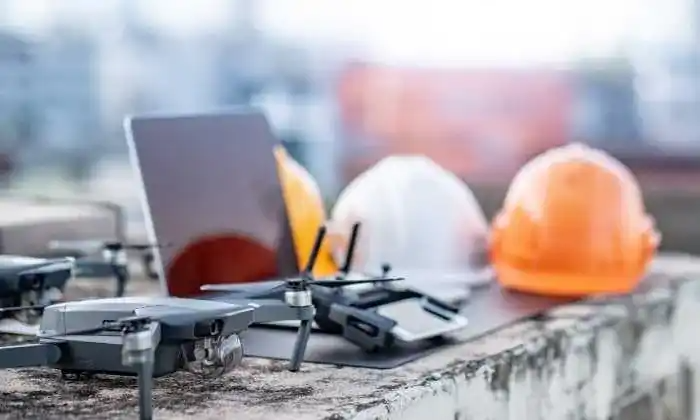
Construction and Inspection Drones
Complete Construction Inspection Drone Solutions for Your Organization
Speak With An Experienced Drone Expert
Revolutionize your construction and inspection processes with the latest drone technology! We offer a wide range of advanced drones designed to help you work smarter, not harder. They are equipped with high-resolution cameras and sensors, making them ideal for site surveying, building inspections, and more. Explore our collection and find the perfect drone for your projects.
Give us a call or email to connect with our UAV Experts.
Call +1868-293-3547 or Email info@kvrel.com
Applications for Construction
7 Ways Drones Can Benefit Farmers and Agriculture Research Bodies
| Application | Description |
|---|---|
|
Precision Farming |
Drones gather precise data about a farm’s fields. They use sensors and imaging capabilities to produce detailed maps that show variations in soil and crop health. With this intel, farmers can selectively apply fertilizers and pesticides, maximizing yield and minimizing expenses. |
|
Crop Health Monitoring |
Before a farmer even spots trouble, drones equipped with multispectral and hyperspectral sensors can pinpoint disease, pests, or stress in plants. Early action means fewer lost crops. |
|
Irrigation Management |
Drones equipped with thermal cameras can identify variations in soil moisture and detect areas of a field that may be over-irrigated or under-irrigated. Farmers using this data can make better decisions on irrigation for efficient water usage and optimizing crop yield. |
|
Planting |
Some drones don’t just hover – they plant! They fire seed pods packed with nutrients into the ground. Even on terrains or conditions too tough for conventional machinery, drones will get the job done. |
|
Livestock Monitoring |
For farmers with large pastures or rangelands, monitoring livestock can be time-consuming. With an aerial view of the livestock, farmers get to ensure that their herds are healthy, well-fed, and safe from predators. Say goodbye to those exhaustive, manual field checks. |
|
Estimating Crop Yields and Growth |
With the high-resolution imagery provided by drones, farmers can estimate crop yields more accurately. They can also monitor growth stages and assess if crops are developing as expected. This allows for better planning of harvest timings and logistics. |
|
Research & Development |
Helping scientists study plant growth, crop response to different inputs, and the impact of environmental factors on agricultural output. |
Drone Applications for Construction & Inspection
Here’s how drones are being used in construction and inspection:
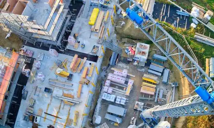
- Site Surveying: Drones for construction inspection allow you to quickly survey a site, gathering accurate data to create 3D models or topographic maps. This data can be used for site planning, design, and management.
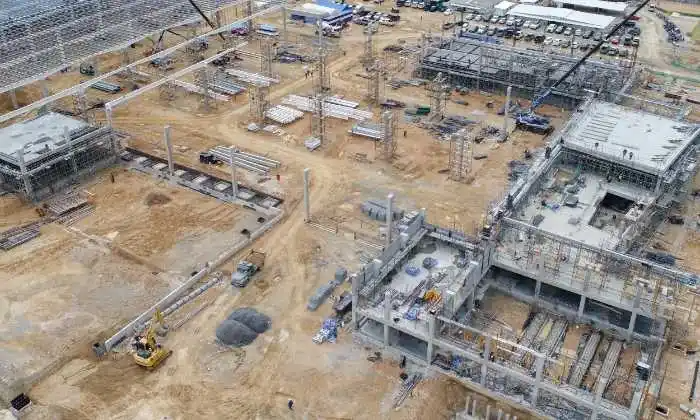
- Building Inspections: Want to inspect that hard-to-reach spot on the rooftop? No need for a ladder or scaffolding. Just send up a drone and get all the details you need without breaking a sweat. Plus, it saves time and avoids the risks of accidents.
- Progress Monitoring: Drones can provide real-time updates on construction progress, making it easier for project managers to monitor workflows, allocate resources efficiently, and make informed decisions.
- Thermal Imaging: Some of the best drones for building inspection come equipped with thermal imaging cameras. These are particularly useful for detecting issues related to insulation, water leaks, or electrical problems.
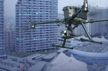
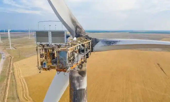
- Structural Inspections: Inspecting large structures like bridges, dams, or towers has never been easier. Drones provide high-resolution images and videos to catch structural issues or wear and tear.
- Safety Compliance: Drones can be used to monitor a construction site for safety compliance, ensuring that all safety protocols are being followed and identifying potential hazards.
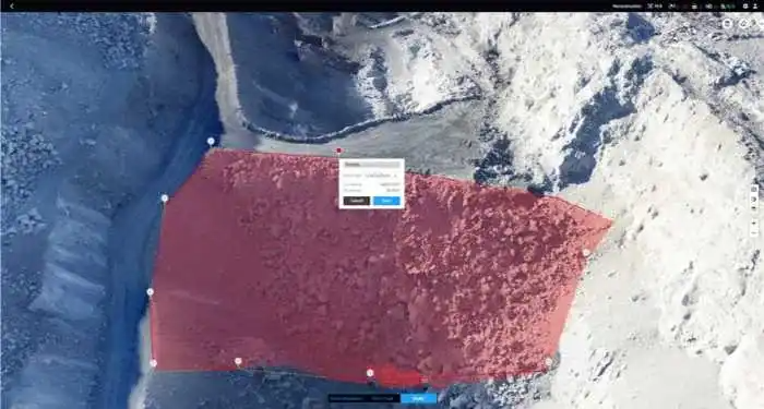
- Volumetric Analysis: Need to measure huge amounts of materials on a site? Drones with LiDAR or photogrammetry come in to analyze the volumes of materials on construction sites, such as earthworks or stockpiles.
- As-Built Surveys: Once your project is done, drones can do a final sweep to provide data for facility management and future maintenance.
- Risk Assessment: By providing an aerial perspective of a construction site, drones can assist in identifying potential risks and planning for risk mitigation.
- Documentation: Drones can capture high-quality images and videos of a construction project, which can be used for marketing purposes, client updates, or project documentation.
When looking for the top Construction & Inspection Drones, consider factors such as flight time, camera quality, ease of use, and data processing capabilities. At KVR Energy, we offer a range of drones suited for construction and inspection needs. Our EVO II 640T Roof Inspection Package is an all-in-one compact solution with a 640 X 512 radiometric thermal camera and 8K video capabilities. The package includes a smart controller for enhanced control and situational awareness.
By incorporating drones into construction and inspection processes, professionals can save time, reduce costs, and improve safety. Explore our range of drones at KVR Energy and find the perfect solution for your needs.
Learn About the Technologies Available for Construction Sites and Drone Inspection
As drone technology evolves, more and more construction and inspection companies are taking advantage of modern drones. While the number of aerial surveying drone options can be daunting, KVR Energy is here to help ensure that your organization is provided with the best drone packages and solutions based on your unique use case, budget, and support needs.
Construction projects are often spread across a large area, which can become difficult to manage without the proper tools. Drones are one of the best ways to address this logistical problem. For building inspection use cases, you will be able to accurately view, monitor and track the structure, construction process and take thermal checks on the exterior of the building’s surface using our drone kits. This imaging ability allows you to safely and quickly check the status of a building to find defects, leakages, and corrosion issues without needing to spend on additional personnel and equipment. Our drone experts at KVR Energy are ready to help your organization with solutions specially configured to assist with your building inspection or construction requirements.
KVR Energy is the professional’s choice for custom-built drone solutions specifically tailored for construction, inspection, surveying, and mapping use cases. One of our friendly and experienced drone experts will work with you to find the best equipment for your specific needs.
The Perfect Drone Solution For Your Use Case
KVR Energy offers specialty drone packages from a variety of drone manufacturers that have each been specifically designed for different verticals. From our Autel EVO II 640T Roof Inspection Package.
With KVR Energy, you’ll get the right equipment at the right price, with the best customer and technical support and service in the industry, and top tier in person training at your location- included free of charge with many packages.
Each of our professional drone kits are designed to quickly, safely and efficiently provide you with actionable data. Ultimately, determining which solution is best depends on your specific needs, and which sensor/camera payload technology is best suited to capture that data.
Main Types of Sensors
Whether you work in urban planning or land surveying and need an aerial surveying solution to easily capture drone images for use in digital elevation models or you require the absolute accuracy of LiDAR to generate point cloud digital terrain models, or radiometric thermal imaging to quickly and safely acquire accurate measurements of industrial infrastructure heat signatures.
Most drones payloads incorporate one or more of these three types of imaging sensors.
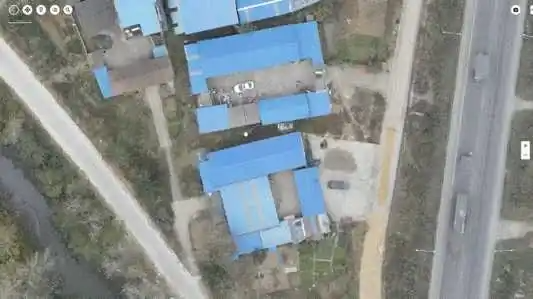
Orthomosaic Mapping
Using different photogrammetry software can result in different outputs from the aerial data and images captured, such as orthomosaic maps, 3D point cloud models, and Digital Surface Models.
Photogrammetry can also be used to accurate volumetric measurement, allowing for data analysis of the resulting 3D map, which provides a very accurate model from which measurements of materials and supplies can be easily made.
The H20 is a high resolution 20 MP camera that offers an incredible 23x hybrid optical zoom with active image stabilization and EIS- perfect for drone inspection uses where you need detailed imagery but can’t get too close to the subject. With a 1200m laser rangefinder, night scene mode and an IP44 rating, the H20 is a powerhouse tool for professional drone operations.
High resolution images and videos of the construction site
Detailed imaging for industrial inspection at a distance
Thermal Sensors
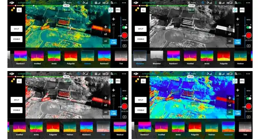
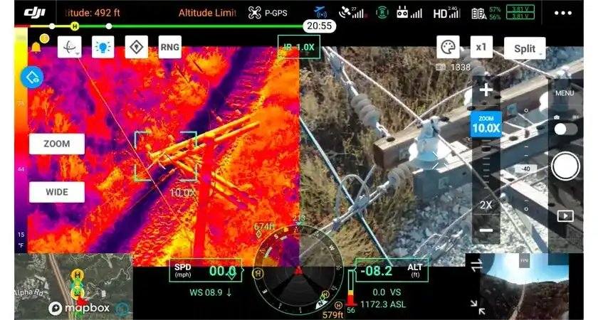
Unlike Optical sensors, thermal sensors don’t capture light that we can see with the naked eye. They capture heat. More specifically, they capture infrared radiation that objects emit, known as a heat signature. Thermal cameras with radiometric capabilities are able measure the exact temperature of any item in their field of view.
This data is incredibly important in industrial inspection. Accurate temperature data can be used to determine errors or issues in a number of inspection scenarios.
During a building or roof inspection, thermal aerial images can help pinpoint where insulation is thin and heat is escaping. This imaging ability allows you to safely and quickly check the status of a building to find defects, leakages, and corrosion issues without needing to spend on additional personnel and equipment.
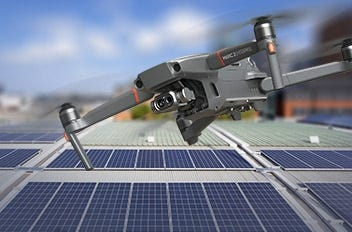
Thermal drones are often used to inspect solar panels. As the drone flies over the solar panels, it is able to take a wide image of the surface, and very easily detect thermal anomalies which signal an issue.
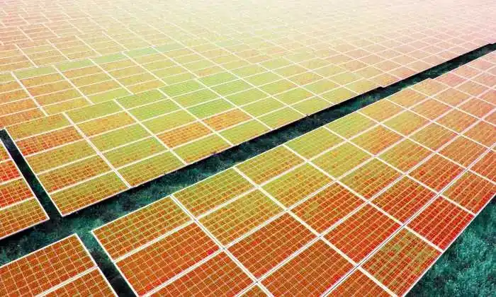
Thermal camera images are able to be customized for different types of data analysis through the use of various color palette settings.
The thermal imaging color palettes typically range from a hot white configuration in which hot items are displayed in white and cooler ones in black, to a hot black configuration in which the color patterns are reversed. Color palettes can show heat in different ways, such as the rainbow setting, which displays the hottest items as red, yellow, or orange, while the coldest are displayed as blue or black.
There are many exciting thermal payloads available for different use cases.
For drone pilots who want to be able to capture both optical and thermal imagery, many commercial drones offer Electro-Optical/Infra-Red (EO/IR) solutions that integrate both visible and thermal sensors.
This is helpful when an inspection requires the ability to take accurate heat measurements, as well as traditional images, which can aid in identifying any externally visible damage to the subject, or aid in locating the exact spot that needs repair.
LiDAR
One of the most exciting technologies to become much more accessible with the rising popularity of drone surveying and inspections is LiDAR.
LiDAR, which stands for Light Detection and Ranging, involves sending laser pulses and determining how long it takes for the lasers to return to the sensor. With the help of inertial measurements and satellite positioning data, the drone’s LiDAR sensor can determine exactly where a point is located in space.
LiDAR point clouds are formed by combining these points with specialized point cloud software. The method is highly accurate, though the maps need to be paired with other data to add more detail, including color.
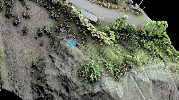
Compared to other methods used by mapping drones, LiDAR is excellent for mapping very small items. LiDAR data, for instance, can be used to generate a point cloud that includes thin cables and electrical lines. In addition to being able to work in low-light conditions, the technology can also penetrate through thick foliage to collect spatial data, resulting in an accurate digital terrain model.
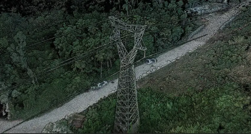
A second advantage is that, since LiDAR point clouds are direct measurements, they have a relatively smaller file size than high-resolution photographs used in photogrammetry. As a result, it is faster to post-process LiDAR survey data than photogrammetry models, which can be very valuable for customers who prioritize efficiency or want to complete an aerial mapping mission within a fixed time.
Conclusion
Ultimately, determining which solution is best for your construction or inspection project depends on your specific needs and the data you want to collect. Whether you need detailed optical imagery, thermal analysis, or precise LiDAR mapping, KVR Energy offers a wide range of drone packages and sensor payloads to cater to your requirements.
Feel free to reach out to our knowledgeable drone experts to discuss your project and get personalized recommendations on the best drone solution for your needs. With the right drone equipment, you can significantly improve efficiency, accuracy, and safety in your construction and inspection operations.
Additional Drone Applications for the Construction, Inspection and Survey Industries
Sophisticated drone construction surveying solutions exist that can provide users with a large range of data over surveyed areas. Builders can create virtual environments with scanned information taken by drones. Geotagging photos and videos through mapping software allows the creation of highly accurate 3D maps and/or cloud points.
This wealth of detailed information allows construction and inspection teams the flexibility to observe and manage large areas with efficiency and an added layer of safety.
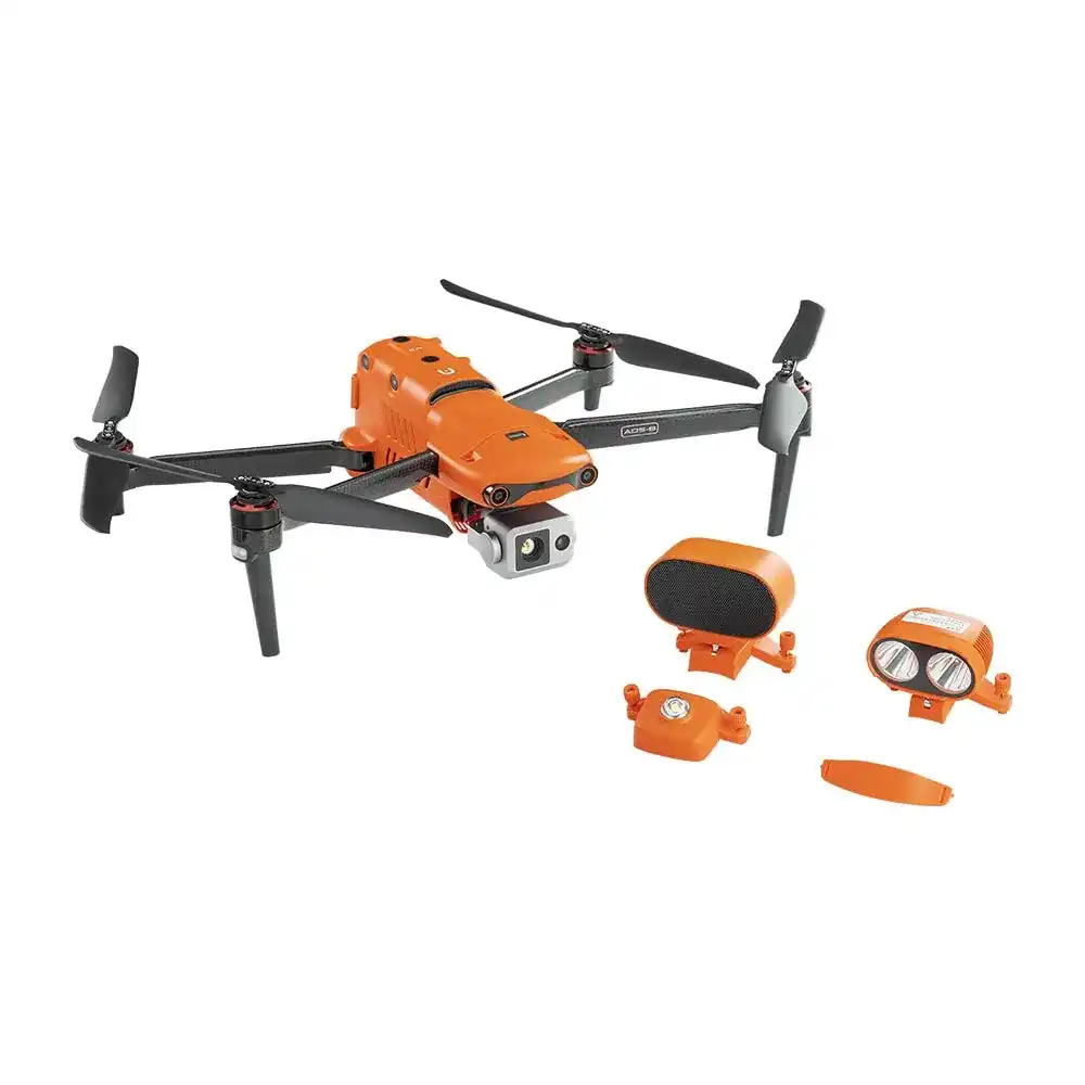
Construction and Inspection Drones and Bundles
*Price exclusive of fees, depending on your country – VAT, Shipping etc.
Give us a call or email to connect with our UAV Experts.
Call +1868-293-3547 or Email info@kvrel.com
UAV THERMAL EXPERTS
We are industry leaders in thermal imaging drones. As one of the pioneers in thermal drone technology, our team of experts will help you build a custom solution that meets both your budget and needs.

MISSION SPECIFIC SOLUTIONS
We specialize in the development and delivery of cost-effective mission-specific enterprise solutions. All our kits are specially designed, assembled, and individually tested for quality assurance in the United States.

AFTER PURCHASE SUPPORT
Our customer service doesn't just end with your purchase; we go the extra mile to make sure our customers have the guidance they need. As our customer, you will know us by name and can count on us for support whenever you need it.